|
Neabsco Creek
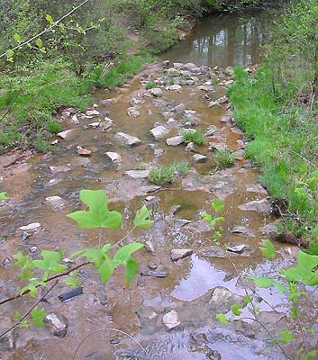
The Neabsco Creek watershed has suffered significant habitat degradation from loss of natural land cover due to past development and storm water facilities designed without consideration of environmental conditions.
Development in the watershed spans the range of low density residential to high density commercial. Neabsco Creek routinely floods Route 1 and other areas in the watershed.
The EPA's Office of Water has identified the Neabsco Creek watershed as an area of significant habitat degradation due to a loss of natural land cover and storm water facilities that were not designed with consideration for environmental conditions. However, the significant costs to offset stormwater impacts have exceeded the amount of funds government can invest and projects to mitigate impacts cannot be completed because of funding shortages.
What has happened to the Neabsco is unfortunate, particularly because it was preventable. Now that the damage to this watershed has been done, repairs such as the described above will be expensive and will never restore the Neabsco to its natural state.
 |
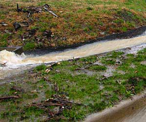 |
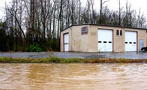
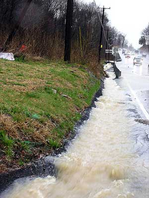
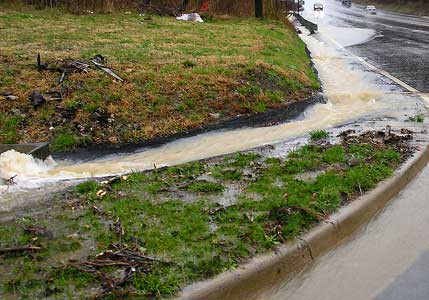
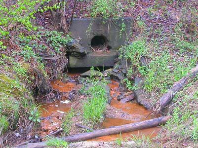
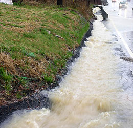
Stormwater runoff on Route 1 north of Cow Branch, Neabsco Creek watershed, on April 3, 2005
The photo at the top of this page shows a building located on the west side of Route 1 near the area where Neabsco Creek flows under the road. On April 3, two lanes of the road were blocked by high waters. Neabsco Creek looked more like the Mississippi River than a stream. Given traffic congestion caused by flooding, it was not possible to photograph Neabsco Creek itself -- the creek was so wide you couldn't get far enough away to capture both banks. The photos to the right show stormwater draining from Route 1 in this same area and overflowing existing stormwater pipes intended to divert runoff into Neabsco Creek.
Back to top |
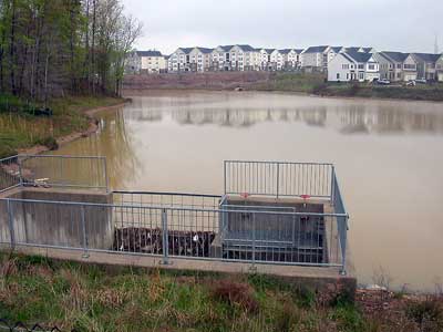
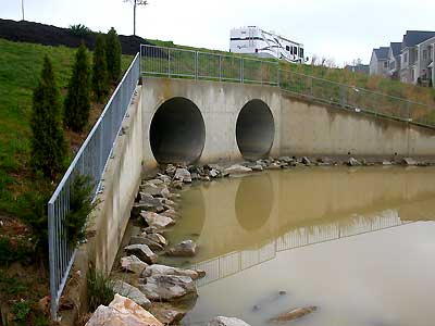
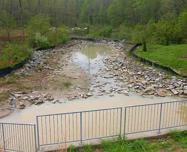
Regional Stormwater Pond and downstream area - headwaters of Neabsco Creek, Government Center development
April 23, 2005
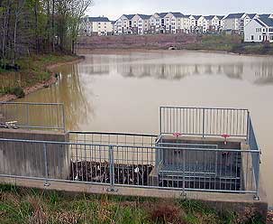 When we visited the new regional stormwater pond located at KSI's County Center development on Prince William Parkway, headwaters of Neabsco Creek, we observed problems at the pond and significant downstream impacts. Although there had been little rain, water was flowing over the dam into a huge spillway connected to two pipes at least 72 inches high. No controls were in place to regulate the flow of water into the pipes; even the small amount of water coming over the dam during our visit traveled directly through the pipes. When we visited the new regional stormwater pond located at KSI's County Center development on Prince William Parkway, headwaters of Neabsco Creek, we observed problems at the pond and significant downstream impacts. Although there had been little rain, water was flowing over the dam into a huge spillway connected to two pipes at least 72 inches high. No controls were in place to regulate the flow of water into the pipes; even the small amount of water coming over the dam during our visit traveled directly through the pipes.
Back to top
|
|
|
|
|
New Problems Add to Old
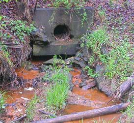 There are stormwater infrastructure problems throughout the Neabsco Creek watershed. Drainage and flooding problems already occur throughout the area. There are stormwater infrastructure problems throughout the Neabsco Creek watershed. Drainage and flooding problems already occur throughout the area.
Much of the watershed was developed before stormwater management was required. In other areas, aging stormwater pipes must be repaired or replaced,which will require significant expenditures of taxpayer dollars.
Back to top |
|
|
|