George Hellwig Memorial Park - Photos taken June 9 2010
This is how the Park Authority is protecting environmental resources at Hellwig Park.
|
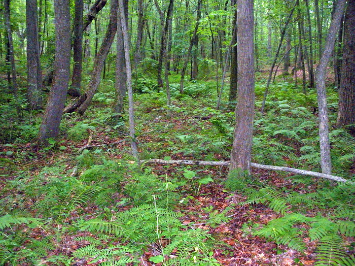 |
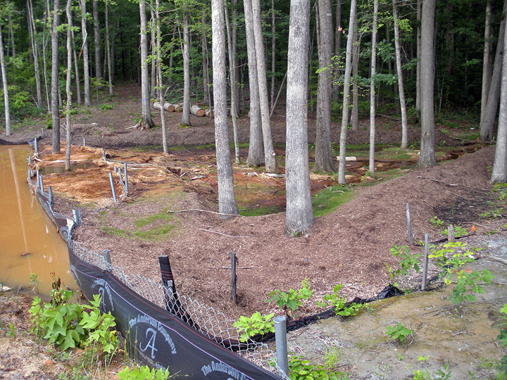
The wetland at Hellwig Park is an environmental asset. The Park Authority claimed it would be protected during the
construction of new ballfields, by placing it inside the "Conservation Area for BMP Purposes." [BMP=Best Management
Practices, designed to meet the requirements of the 1972 Clean Water Act.] The site plan filed by the Park Authority for the
Hellwig Ballfields Development delineated the wetland boundaries, and stated "This channel contains documented wetlands and is
to be left undisturbed in order to preserve the natural conditions." |
|
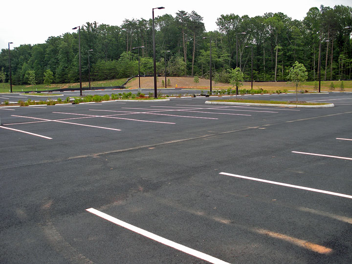 |
The Park Authority assumes parking for 60 cars is required for each ballfield. The new parking lot, adding capacity for about
300 cars, drains directly to a stormwater pond. In theory, rain that flows off the impervious paved surface is captured at
the pond and released slowly. |
|
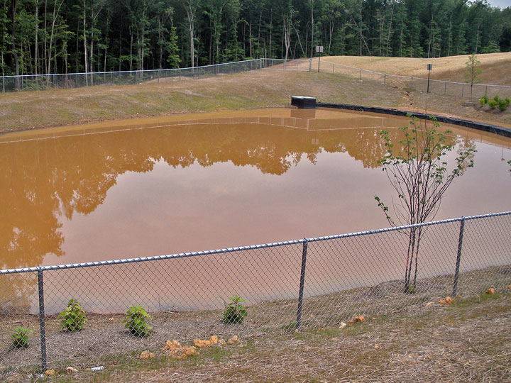 |
The stormwater pond is a common component of new construction. (When Dale City was built, no stormwater controls were
required, but Virginia required management of that source of pollution starting in 1991.) Engineers try to mimic how water
flowed off the site before construction, so there are no offsite impacts. The water that is discharged from the stormwater
pond at Hellwig drains into Conservation Area, flows through the natural wetland, then leaves Hellwig Park and runs into a
fishing pond on private land. Water from Hellwig Park ends up in Quantico Creek and ultimately the Chesapeake Bay. |
|
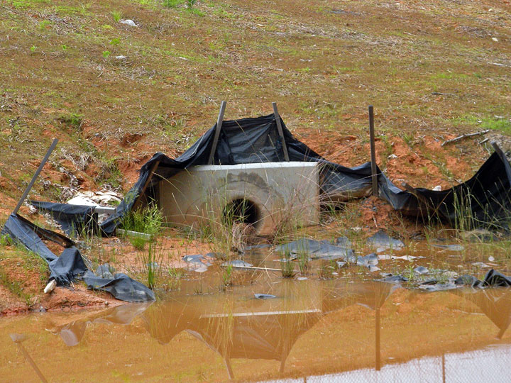 |
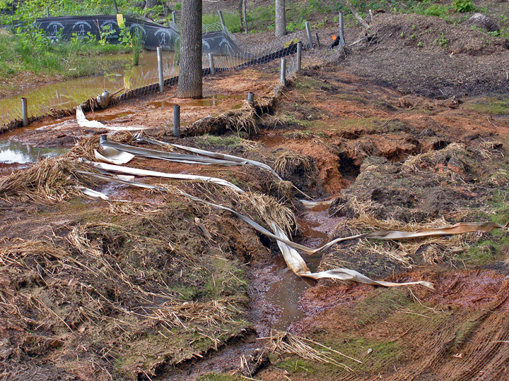
The discharge outlet of the stormwater pond, near the boundary between the construction site and the Conservation Area. The
silt fence is supposed to intercept sediment that flows off the hillside, until the grass is established. Think it is working
effectively? |
|
 |
Below the stormwater pond, the discharge is slowed by another silt fence. According to the site plans for the ballfields construction project, a wide "level spreader" will be constructed here. That device will supposedly spread the stormwater so it flows at no more than 2.5 feet/second, during the average storm expected every two years (5.75 inches of rainfall/hour). The complex engineering calculations required for design of stormwater controls make it difficult for the average citizen to assess proposed designs - but anyone with decent eyesight can evaluate if the stormwater controls actually work, or not. |
|
 |
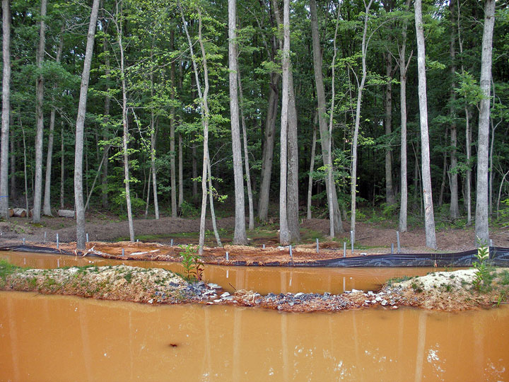
The silt fence, so completely silted up that it no longer slows runoff from a storm. Note the artificial levees contructed in the Conservation Area, to channel the water that is flowing over the silt fence. No effort has been made to disguise the impact on an area that was supposed to be left "undisturbed in order to preserve the natural conditions." |
|
 |
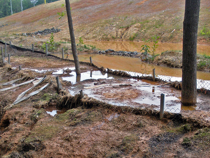
The sediment that has already washed over the silt fence is evident. |
|
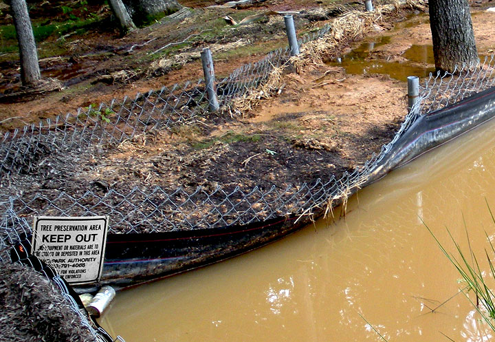 |
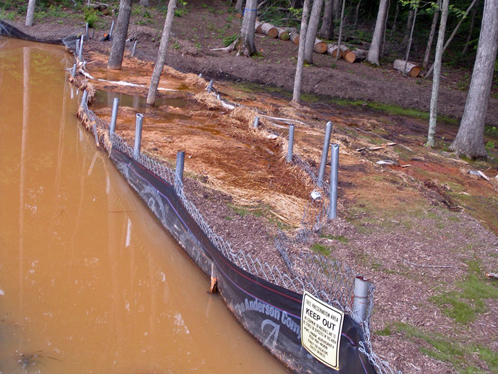
Evidently the polluted runoff from the construction project can't read the signs... and neither can the Park Authority. |
|
 |
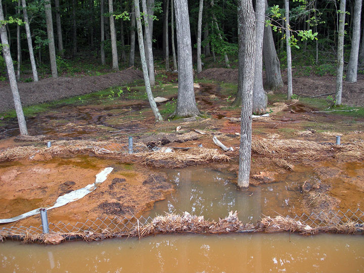
More of the construction and stormwater damage to the supposed Conservation Area. |
|
 |
The amount of stormwater, and its power to erode, is evident at the silt fence. |
|
 |
Sediment that washed off the construction site, being eroded further from behind the silt fence. Of the three major sources of pollution that are damaging the Chesapeake Bay, stormwater is the one source that is getting worse. (Efforts to control agricultural runoff and wastewater from sewage treatment plants are having some success.) |
|
 |
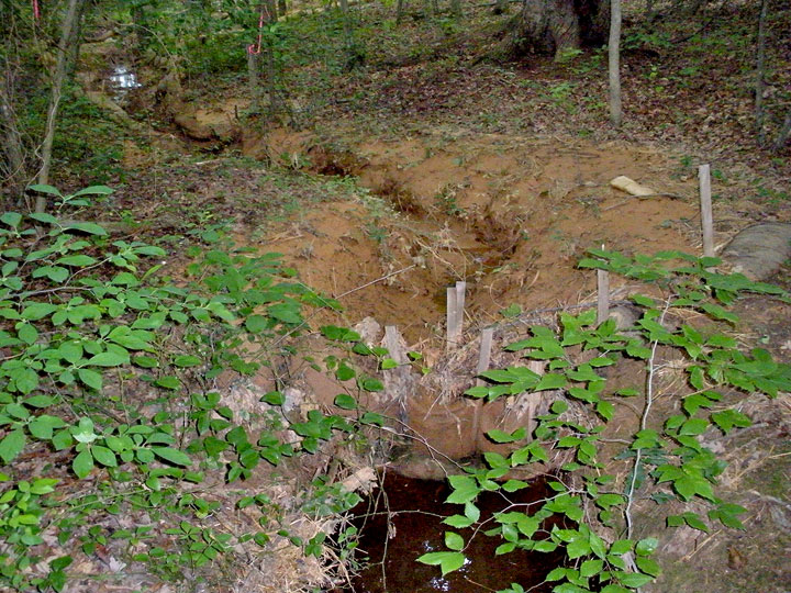
End of high artificial levees constructed in Conservation Area, and start of smaller artificial barriers intended to be high enough to keep runoff in artificial channel. |
|
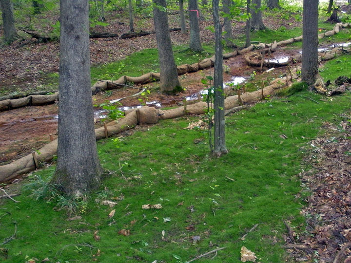 |
On either side of the artificial channel, the Park Authority has planted a grass species that would not normally grow in a natural wetland. The site plan provided no information regarding fertilizer and pesticides that may have been included in the grass mixture, since in theory the wetland was to be left undisturbed. |
|
 |
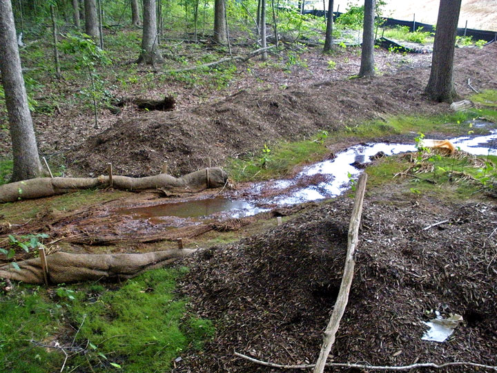
Natural wetlands channel was replaced with artificial path carved through Conservation Area. . |
|
 |
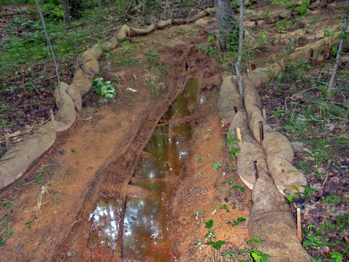
Small barriers on either side of altered stream channel were not adequate to control the excessive stormwater from the construction site. Sediment flowing down from stormwater pond has been deposited outside the barriers, indicating how runoff flowed through the once-natural wetland. </p> |
|
 |
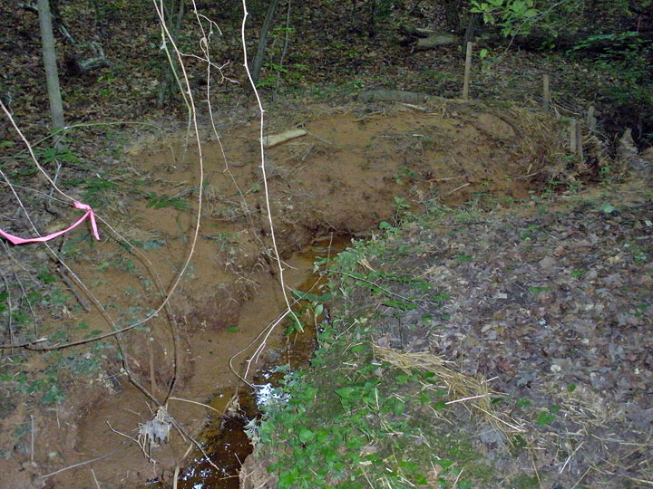
Confluence where runoff from stormwater pond meets with natural wetland channel coming in at right side of picture. Notice sediment outside channel, indicating how much/how fast the water flowed from the construction site. |
|
 |
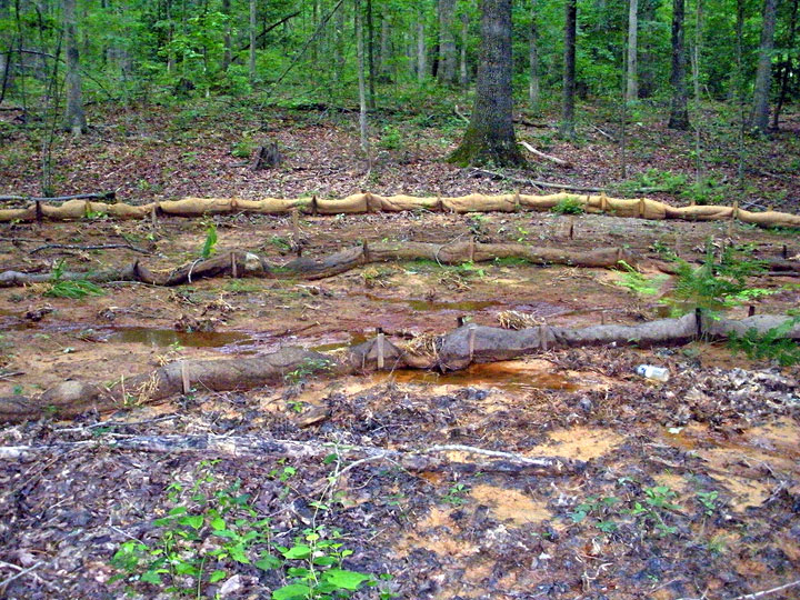
About 75 feet into the "Conservation Area for BMP Purposes," the Park Authority has placed a final dam in the middle of the natural stream channel. Sediment has overflowed that dam as well. |
|
 |
More evidence of excessive stormwater runoff in wetland channel, further downstream. |
|
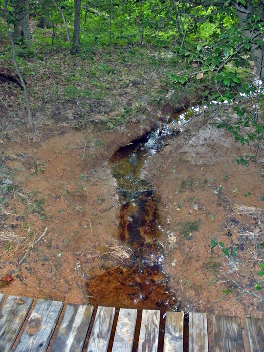 |
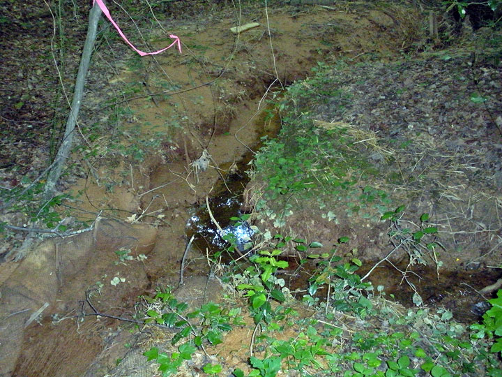
Sediment from the ballfields is clogging the wetland channel all the way past the Park Authority trail with white blazes. |
|
|