Possum Point Road:
Why was the developer not required to follow the approved site plan?
Many meetings to discuss long-term solutions have been held since onset of construction at Southbridge/Swan Creek in the late 1990's. Uwe Kirste, Prince William County Public Work's Chief of Environmental Services, has met with Possum Point Road residents, local watershed organizations, Legend Properties' project manager Mike Anderson and representatives from the builders working at the Swann Creek site. Although the problems were obvious, discussions about solutions quickly revealed both the developer's resistance to implement the needed mitigation and Public Works reluctance to require compliance with approved plans.
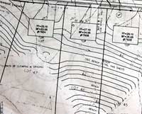
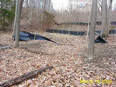
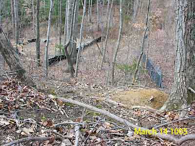
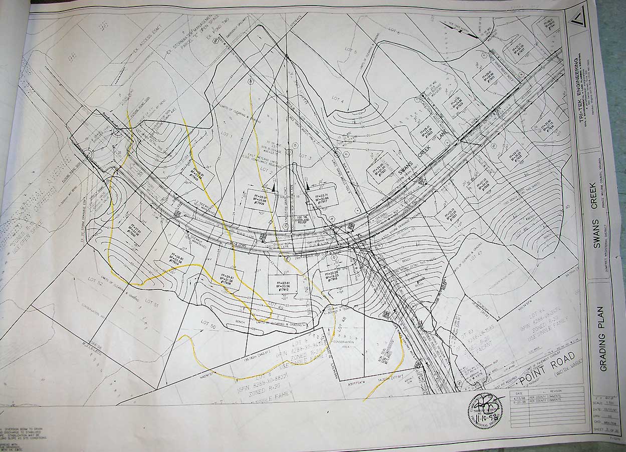
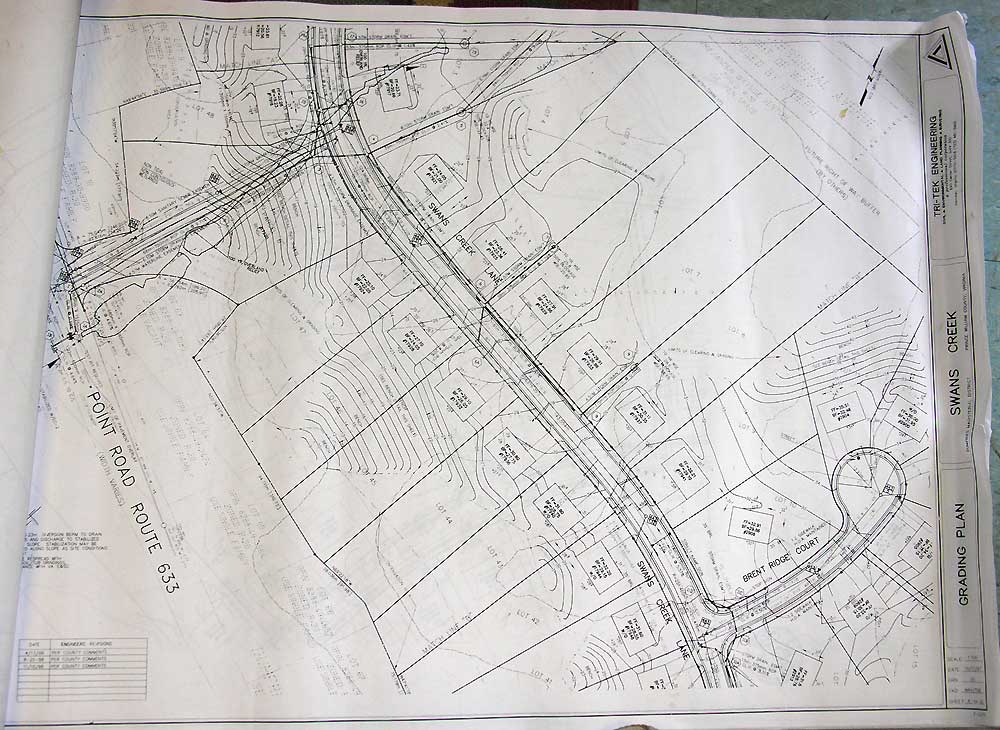
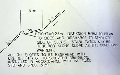
A review of the Swann Creek site plan shows major inconsistencies between the approved plan and on-the-ground realities. One obvious difference between planned and actual construction is found adjacent to homes along Possum Point Road, where the approved plan called for terracing and check dams. Reality instead showed a steep rise created by dumping of fill dirt, radical changes to the natural drainage pattern and property damage to homes on Possum Point Road .
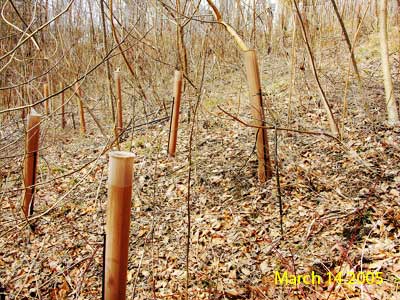
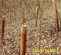 The approved plan also called for revegetation of the area behind Possum Point Road homes, which is now a steep slope to roads and roofs (impervious surface). Although there is evidence that some planting occurred, current conditions show that the effort largely failed. Today this area is covered with ailanthus trees and other invasive plants, a significant step backward from the high quality forest that existed prior to the development. The approved plan also called for revegetation of the area behind Possum Point Road homes, which is now a steep slope to roads and roofs (impervious surface). Although there is evidence that some planting occurred, current conditions show that the effort largely failed. Today this area is covered with ailanthus trees and other invasive plants, a significant step backward from the high quality forest that existed prior to the development.
Through the years, many many meetings have been convened to discuss solutions. This time investment on the part of residents, watershed organizations and government agencies has resulted in little action and a situation virtually unchanged. Moreover, the community's original question remains unanswered: Why did Prince William County not require the developer to follow the approved site plan?
 |
 |
 |
|
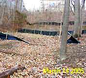
Constructed hill behind
Possum Point homes,
view from the bottom.
March 2005 |
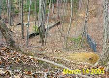
Constructed hill behind
Possum Point homes,
view from the top.
March 2005 |
|